The Hidden Depths of Pokémon GO: How Niantic is Revolutionizing Mapping Technology
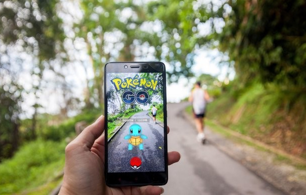
When Pokémon GO launched in July 2016, it seemed like a simple yet innovative game that encouraged players to get outside, explore their communities, and capture virtual creatures. However, as the app matured, so did its technology and applications. What began as a playful way to blend augmented reality (AR) with gaming has evolved into a sophisticated geolocation tool with profound implications for technology, navigation, and urban development.
Niantic, the developer of Pokémon GO, has leveraged the game’s massive user base to build one of the most advanced geolocation mapping systems in the world. Today, the app is more than just a game—it’s a global mapping tool powered by millions of players, creating detailed 3D recreations of real-world spaces. This blog explores how Pokémon GO has become a powerful geolocator, the technology behind it, and its potential applications beyond gaming.

Pokémon GO requires players to interact with the physical world. They travel to real-world locations to catch Pokémon, spin Pokéstops, and battle at Gyms. This movement and interaction serve a dual purpose. Not only does it make the game more engaging, but it also allows Niantic to collect invaluable geospatial data.
As of 2024, Niantic has developed in-depth scans of over 10 million real-world locations. Players contribute around one million new individual scans weekly by using their smartphones to interact with the AR features in the game. These scans—comprised of photos, videos, and geolocation data—are uploaded to Niantic’s servers, where they are analyzed and compressed into detailed 3D models. This massive, crowdsourced database serves as the foundation for Niantic’s cutting-edge mapping technology.
At the core of Niantic’s mapping capabilities lies its use of neural networks—machine learning algorithms inspired by the human brain. According to Niantic, these networks are used to train and compress the hundreds of millions of scans into digital recreations of physical spaces. Over 50 million neural networks are reportedly involved in this process, each specialized in analyzing and interpreting different types of data.
Key Steps in the Process:
- Data Collection
Users capture images and videos of real-world locations while playing Pokémon GO. This data is geotagged and includes visual and spatial information about the area. - Neural Network Training
Niantic’s neural networks process this data to identify key features of each location, such as landmarks, building outlines, and pathways. These features are then compiled into a 3D map. - Compression and Recreation
The system compresses thousands of images and scans into a single, high-quality digital recreation of the space. These recreations are stored in Niantic’s database and used to enhance the app’s AR capabilities. - Real-World Applications
The resulting data can be used for various applications, from improving AR experiences to optimizing navigation and supporting autonomous systems.

Niantic’s mapping technology is crucial for advancing AR products. By creating highly detailed 3D maps, Niantic can ensure that AR objects interact seamlessly with the real world. This has applications beyond gaming, including retail, education, and entertainment.
Self-driving cars and drones rely heavily on accurate maps to navigate safely and efficiently. Niantic’s technology could be instrumental in creating the next generation of maps for these autonomous systems, especially in urban environments. Traditional GPS systems are often limited in their accuracy, especially in dense urban areas where tall buildings can block satellite signals. Niantic’s maps, created from user-generated data, provide a more detailed and reliable navigation solution.
Cities can use this data to analyze pedestrian movement and optimize infrastructure. For example, understanding the most frequently traveled walking paths could help city planners design better sidewalks, bike lanes, and public spaces.
While the technology is impressive, it also raises important ethical questions. Users often contribute to Niantic’s mapping efforts without fully understanding how their data is being used. Additionally, concerns about privacy and data ownership are ever-present in discussions about geolocation and crowdsourcing. Players may not realize that by playing Pokémon GO, they are contributing to a global mapping project. Niantic includes information about data collection in its terms of service, but how many users read and understand these agreements?
What started as a mobile game has grown into a groundbreaking geolocation tool with endless possibilities. By harnessing the power of crowdsourced data and neural networks, Niantic has transformed Pokémon GO into a platform that not only entertains but also drives technological innovation. From improving AR experiences to revolutionizing navigation and urban planning, the potential applications of this technology are vast.
As we look to the future, it’s clear that Pokémon GO is more than just a game. It’s a glimpse into a world where the physical and digital realms are seamlessly integrated—a world where every scan, every interaction, and every step can contribute to a smarter, more connected planet.
